HISTORIX Vintage 1883 Map of Wyoming - 18x24 and 50 similar items


Free Shipping
HISTORIX Vintage 1883 Map of Wyoming - 18x24 Inch Vintage Wyoming Map Poster - O
£30.03 GBP - £41.30 GBP
View full item details »

Shipping options
Seller handling time is 1 business day Details
No shipping price specified to GB
Ships from
United States

Return policy
Full refund available for DOAs
Details
Purchase protection
Payment options
PayPal accepted
PayPal Credit accepted
Venmo accepted
PayPal, MasterCard, Visa, Discover, and American Express accepted
Maestro accepted
Amazon Pay accepted
Nuvei accepted
View full item details »
Shipping options
Seller handling time is 1 business day Details
No shipping price specified to GB
Ships from
United States
Return policy
Full refund available for DOAs
Details
Purchase protection
Payment options
PayPal accepted
PayPal Credit accepted
Venmo accepted
PayPal, MasterCard, Visa, Discover, and American Express accepted
Maestro accepted
Amazon Pay accepted
Nuvei accepted
Item traits
| Category: | |
|---|---|
| Quantity Available: |
16 in stock |
| Condition: |
New |
| ASIN: |
B091F6T59D |
| Item Name: |
HISTORIX 1883 Wyoming |
| manufacturer: |
HISTORIX |
| Item Type Keyword: |
prints |
| Product Site Launch Date: |
2021-03-31T08:15:36.633Z |
| Brand: |
HISTORIX |
| Unspsc Code: |
52140000 |
| sizes: |
Listing details
| Seller policies: | |
|---|---|
| Shipping discount: |
Seller pays shipping for this item. |
| Posted for sale: |
April 27 |
| Item number: |
1742885632 |
Item description
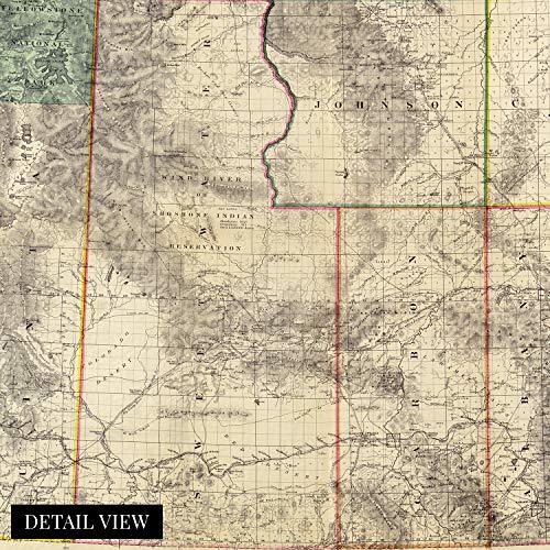
Published by one of Wyoming’s earliest settlers, George L. Holt, seven years before the territory achieved statehood, this detailed depiction of Wyoming shows it in a period of significant growth and transformation. The Union Pacific Railroad played a pivotal role in opening Wyoming up to immigration and settlement. Europeans were flocking to the territory in the latter portion of the nineteenth century. Unlike its neighbor to the south, Wyoming never experienced a gold and silver mining boom like Colorado; it did become a hub for coal mining in the 1880s. The region also enjoyed a robust cattle ranching industry that thrives to this day.
Holt established a drugstore in Cheyenne with his wife in 1867 when the Union Pacific reached the remote outpost and became a successful druggist, businessman, and publisher. Holt is only known to have published two maps in his career, both depicting Wyoming in 1883 and again in 1888. This relative scarcity sets this illustration apart and makes it a rare piece of cartographical history. The distinctive style and immediately recognizable aesthetic transports the viewer back in time, creating an indelible bond between the past and present.
Home to one of America’s most iconic natural landscapes, Yellowstone National Park, Wyoming, has attracted tourists since its establishment in 1872. This map was Illustrated by prominent American cartographers Fred and Frank Bond during one of the first cattle booms in Wyoming and is thought to be one of the earliest representations of Wyoming with considerable detail and accuracy.
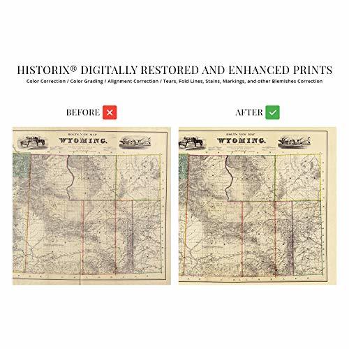
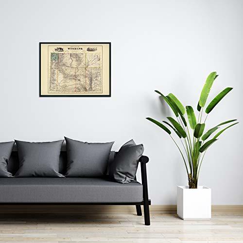
Our museum quality giclee print comes printed with archival ink on premium heavyweight matte paper. This eye-catching vintage map reproduction print makes the perfect gift for anyone that loves history and imagery.
|
Why are we showing these items?
Booth
Historic Prints |

|


-
Refine your browsing experience
We can show you more items that are exactly like the original item, or we can show you items that are similar in spirit. By default we show you a mix.


This item has been added to your cart
 HISTORIX Vintage 1883 Map of Wyoming - 18x24 Inch Vintage Wyoming Map Poster - O added to cart.
16 available in stock
HISTORIX Vintage 1883 Map of Wyoming - 18x24 Inch Vintage Wyoming Map Poster - O added to cart.
16 available in stock
View Cart or continue shopping.
 Please wait while we finish adding this item to your cart.
Get an item reminder
We'll email you a link to your item now and follow up with a single reminder (if you'd like one). That's it! No spam, no hassle.
Already have an account?
Log in and add this item to your wish list.