HISTORIX Vintage 1776 Philadelphia Pennsylvania Map - 18x24 Inch Vintage Map of
Ships from
United States

Shipping options
Seller handling time is 1 business day Details
This reflects the seller's handling time and may not include time spent in transit.
If you have questions about shipping, please contact the seller.
No shipping price specified to GB
Ships from
United States
Return policy
Full refund available for DOAs
Details
- We guarantee our products and offer full refunds or exchange for defective items or items not as-described.
- Buyer must contact us within 30 days after receipt of shipment.
- The item must be received in the same condition as shipped.
- Items must be returned with all original packaging and accessories.
- Items must not be abused, modified or damaged by accident.
- A 20% restocking fee will be charged for returns
- Buyer is responsible for all return shipping and handling fees.
- Restocking and return shipping fees do not apply when item is returned as defective or because incorrect product was delivered.
Payment options
PayPal accepted
PayPal Credit accepted
Venmo accepted
PayPal, MasterCard, Visa, Discover, and American Express accepted
Maestro accepted
Amazon Pay accepted
Nuvei accepted
Item traits
| Category: |
Books & Magazines
|
| Quantity Available: |
16 in stock
|
| Condition: |
New
|
| UPC: |
737214977117
|
| Item Name: |
1776 Philadelphia Pennsylvania Poster Print
|
| Item Type Keyword: |
prints
|
| Unspsc Code: |
10111300
|
| sizes: |
View details
18x24 Inch (8 in stock)
36L" x 24W" (8 in stock)
|
Listing details
|
Seller policies:
|
View seller policies
|
|
Shipping discount:
|
Seller pays shipping for this item.
|
|
Posted for sale:
|
April 27
|
|
Item number:
|
1742924221
|
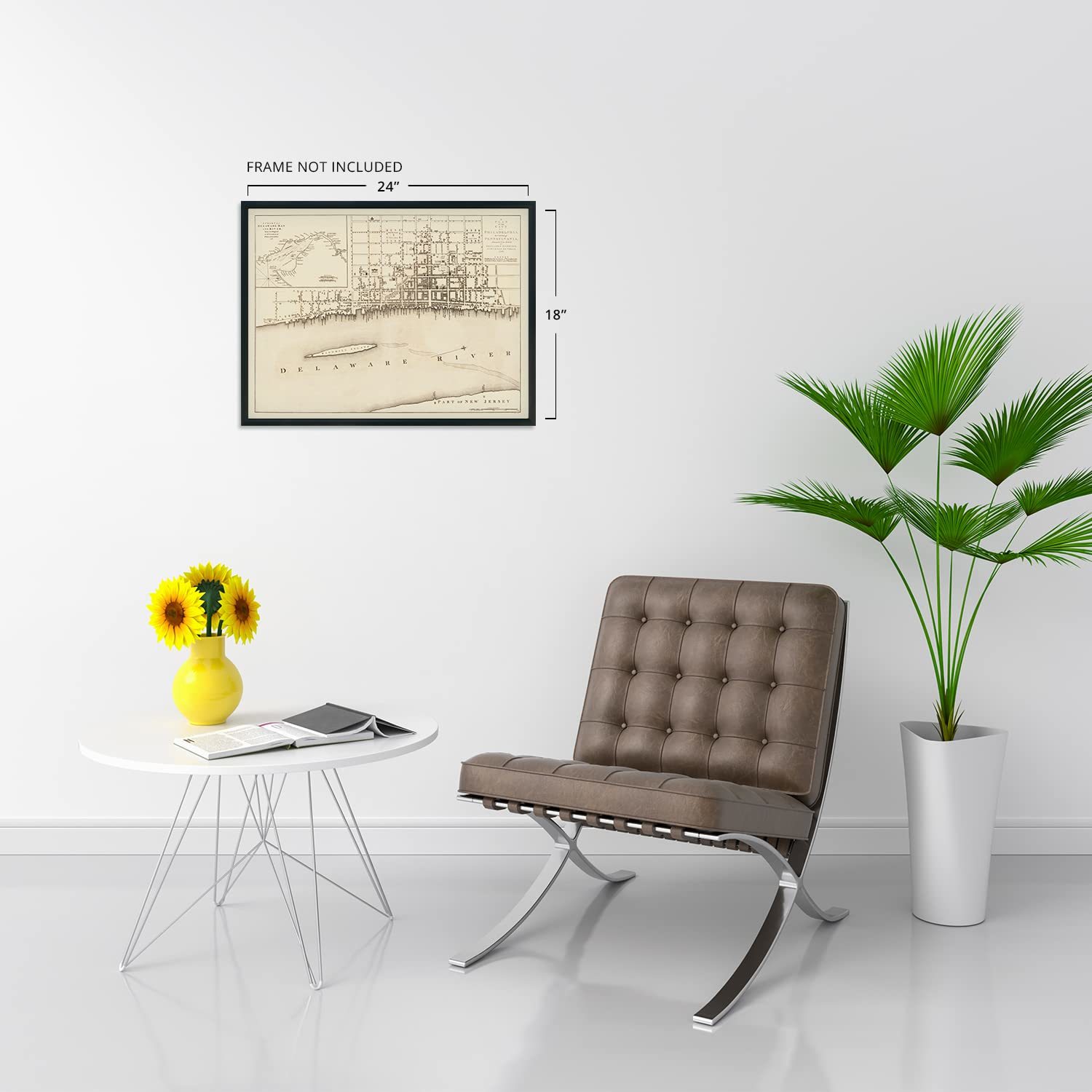
Published in the same year as the Founding Fathers signed the Declaration of Independence, this early depiction of Philadelphia is a historically significant piece of early American cartographic history. Europeans began settling the region in the early seventeenth century, with Dutch colonies being established on the banks of the Delaware River. These initial settlements were followed by immigrants from Sweden, Finland, and England who would develop a peaceful relationship with surrounding indigenous peoples, resulting in Philadelphia's rapid growth and prosperity through the following centuries. By the time of this publication, it was the most influential American city.
Both its political, cultural, and economic significance as well as its geographic location made it the center for American Revolutionary forces both during and leading up to the Revolutionary War. The city was the site of several battles during the conflict, and British General Howe occupied the city in 1777. By the 1750s, Philadelphia had surpassed Boston to become the largest city with a thriving port that exported goods back to England. Philadelphia was the United States capital from 1790 to 1800 as the District of Columbia was under construction.
Benjamin Easburn was a noted surveyor of the time, and this map's minimal aesthetic and classic style distinguishes it from more ornate works of the time. The late eighteenth century was perhaps the most formative period for what would become the United States as it gained independence from Colonial British rule and embarked on a bold path of democratic governance and increased prosperity.
Our museum quality giclee print comes printed with archival ink on premium heavyweight matte paper. Shipped in a sturdy cardboard tube your print will arrive ready to be framed. This eye-catching vintage map reproduction print makes the perfect gift for anyone that loves history and imagery.