HISTORIX Vintage 1879 Chambers County Texas Map Poster - 18x24 Inch Chambers Tex
Ships from
United States

Shipping options
Seller handling time is 1 business day Details
This reflects the seller's handling time and may not include time spent in transit.
If you have questions about shipping, please contact the seller.
No shipping price specified to GB
Ships from
United States
Return policy
Full refund available for DOAs
Details
- We guarantee our products and offer full refunds or exchange for defective items or items not as-described.
- Buyer must contact us within 30 days after receipt of shipment.
- The item must be received in the same condition as shipped.
- Items must be returned with all original packaging and accessories.
- Items must not be abused, modified or damaged by accident.
- A 20% restocking fee will be charged for returns
- Buyer is responsible for all return shipping and handling fees.
- Restocking and return shipping fees do not apply when item is returned as defective or because incorrect product was delivered.
Payment options
PayPal accepted
PayPal Credit accepted
Venmo accepted
PayPal, MasterCard, Visa, Discover, and American Express accepted
Maestro accepted
Amazon Pay accepted
Nuvei accepted
Item traits
| Category: |
Kitchen Scales
|
| Quantity Available: |
16 in stock
|
| Condition: |
New
|
| UPC: |
737214980704
|
| Item Name: |
1879 Chambers County Texas Poster Print
|
| Item Type Keyword: |
prints
|
| sizes: |
View details
24L" x 18W" (8 in stock)
36L" x 24W" (8 in stock)
|
Listing details
|
Seller policies:
|
View seller policies
|
|
Shipping discount:
|
Seller pays shipping for this item.
|
|
Posted for sale:
|
April 29
|
|
Item number:
|
1743218072
|
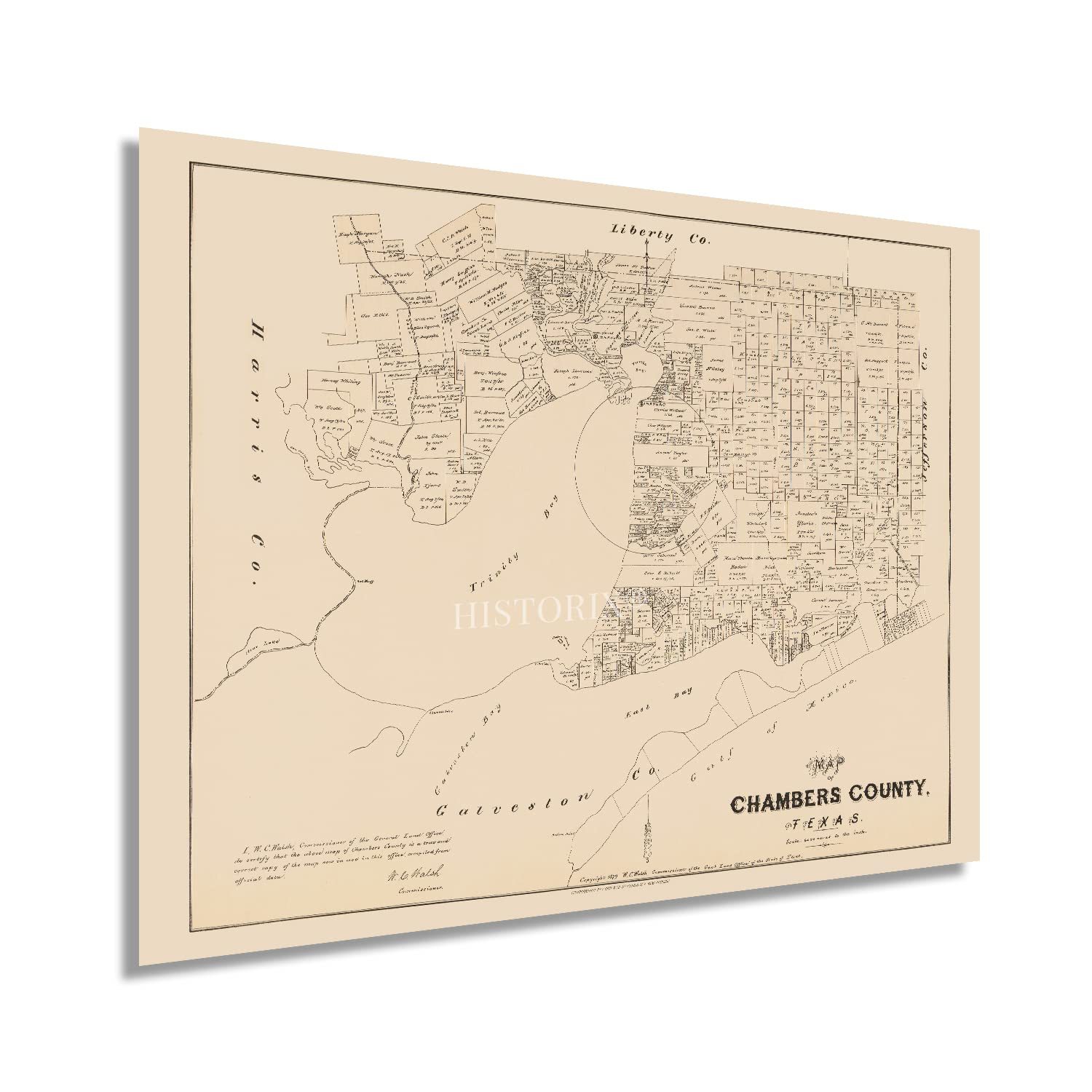
Named for Major General Thomas Jefferson Chambers, a key figure in the Texas Revolution, Chambers County comprises one of nine of the greater Houston metropolitan area. With the Gulf of Mexico at the Southeastern boundary, the County was critical to the settlement of the region during the nineteenth century. The County also contains portions of the Trinity and Galveston Bay. The First Spanish mission was founded in 1756, and European and American influences shaped the local culture for the following decades. Chambers County is now home to the Anahuac and Moody National Wildlife Refuges which protect the local eco-systems.
Produced by the Texas Land Commission under the direction of Civil War Veteran William C. Walsh, this classic depiction captures a rare glimpse into the history and development of the County. After his tenure with the commission, Walsh directed the initial survey for the one-hundred acres that would become the University of Texas at Austin. This map bears a signature, minimal style that was heavily utilized by the Land Commission and used to verify subsequent surveys and other official land documents. Another interesting feature of these maps is that they allow historians and genealogists to track and maintain the land ownership records for the area to create historical narratives that depict the evolution of the region.
Numerous groups of immigrants founded neighborhoods and communities along cultural lines in the towns and cities of the area, many of which exist to this day. This is an authentic piece of American cartographical history.
Our museum quality giclee print comes printed with archival ink on premium heavyweight matte paper. Shipped in a sturdy cardboard tube your print will arrive ready to be framed. This eye-catching vintage map reproduction print makes the perfect gift for anyone that loves history and imagery.