HISTORIX Vintage 1763 Colonial America Map - and 50 similar items


Free Shipping
HISTORIX Vintage 1763 Colonial America Map - 18x24 Inch Vintage Map of Colonial
£30.21 GBP - £45.33 GBP
View full item details »

Shipping options
Seller handling time is 1 business day Details
No shipping price specified to GB
Ships from
United States

Return policy
Full refund available for DOAs
Details
Purchase protection
Payment options
PayPal accepted
PayPal Credit accepted
Venmo accepted
PayPal, MasterCard, Visa, Discover, and American Express accepted
Maestro accepted
Amazon Pay accepted
Nuvei accepted
View full item details »
Shipping options
Seller handling time is 1 business day Details
No shipping price specified to GB
Ships from
United States
Return policy
Full refund available for DOAs
Details
Purchase protection
Payment options
PayPal accepted
PayPal Credit accepted
Venmo accepted
PayPal, MasterCard, Visa, Discover, and American Express accepted
Maestro accepted
Amazon Pay accepted
Nuvei accepted
Item traits
| Category: | |
|---|---|
| Quantity Available: |
12 in stock |
| Condition: |
New |
| ASIN: |
B08NSKHJMV |
| Item Name: |
HISTORIX 1763 Colonial America |
| manufacturer: |
HISTORIX |
| Item Type Keyword: |
prints |
| Brand: |
HISTORIX |
| Unspsc Code: |
52140000 |
| sizes: |
Listing details
| Seller policies: | |
|---|---|
| Shipping discount: |
Seller pays shipping for this item. |
| Posted for sale: |
April 15 |
| Item number: |
1739657839 |
Item description
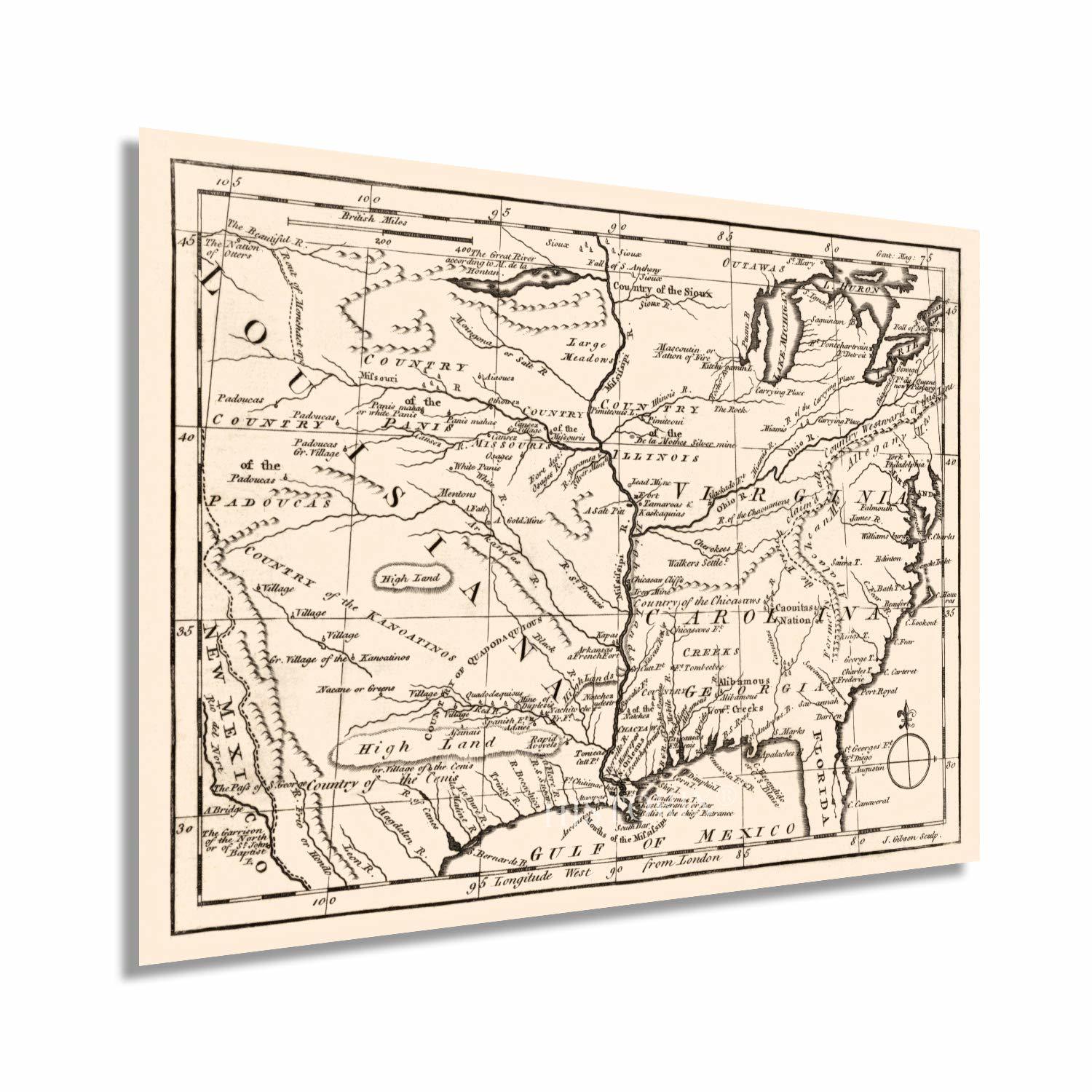
Produced by noted British engraver and cartographer John J. Gibson, this rare depiction of the American Colonies published in 1763 immediately transports the viewer back in time, creating an indelible link between the past and the present. Gibson, who was famous for his 1758 publication of his pocket atlas, Atlas Minimus, is recognized as one of the most important early American cartographers.
The first successful community was established in Jamestown in what is present-day Virginia near the Chesapeake Bay. But by the later portions of the 18th century, the Colonies had grown embittered towards English rule, and the roots of the American Revolution were being established. Published some twelve years before the outbreak of the Revolution, this map shows the colonies in a period of prosperity and growth. The Revolution would last for more than a decade and would serve as the inspiration for democratic governance across Europe.
This map was created for Gentleman’s Magazine, which was published monthly in London uninterrupted from 1731 to 1922. Though this map only extends to the Rocky Mountains in the West, it was one of the most complete productions of the era.
The Colonies in the years leading up to the Revolution were growing dissatisfied with British taxation and supreme authority. Rumors of Revolution were spreading throughout the colonies, and acts of outright rebellion caused growing tensions between colonists and the British military and government. By 1763 the Colonies had long-established towns and cities, and this engraving is an authentic piece of American cartographical history.
Our museum quality giclee print comes printed with archival ink on premium heavyweight matte paper. Shipped in a sturdy cardboard tube your print will arrive ready to be framed. This eye-catching vintage map reproduction print makes the perfect gift for anyone that loves history and imagery.
|
Why are we showing these items?
Booth
Historic Prints |

|


-
Refine your browsing experience
We can show you more items that are exactly like the original item, or we can show you items that are similar in spirit. By default we show you a mix.


This item has been added to your cart
 HISTORIX Vintage 1763 Colonial America Map - 18x24 Inch Vintage Map of Colonial added to cart.
12 available in stock
HISTORIX Vintage 1763 Colonial America Map - 18x24 Inch Vintage Map of Colonial added to cart.
12 available in stock
View Cart or continue shopping.
 Please wait while we finish adding this item to your cart.
Get an item reminder
We'll email you a link to your item now and follow up with a single reminder (if you'd like one). That's it! No spam, no hassle.
Already have an account?
Log in and add this item to your wish list.